24 Oct Fences do not always indicate Property Boundaries
Property boundaries are not always obvious. While a fence, hedge or driveway may look as though it defines the edge of a property, the actual boundary locations can be quite different. In many areas the boundary pegs may be missing, eroded by time or previously removed by building works. If the boundary pegs are not obvious it may be prudent to have them located or replaced before any design, development or building development works commence.
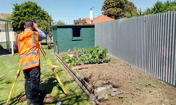
Licensed Cadastral Surveyors are the only persons permitted to place surveys pegs, which determine the property boundaries. Although the end result may appear simple, i.e. generally a white painted peg in the ground, you should be aware that the surveyor has undertaken significant work to ensure that the peg is in the correct location. Fraser Thomas Ltd has a number of Licensed Cadastral Surveyors, all of whom are experienced in undertaking this type of work.
Survey works to reliably locate boundaries involves examining and interpreting the existing survey records, some of which may date back to the 1800’s. The surveyor then needs to undertake sufficient field work to locate and verify the reliability of enough old survey marks to be able to relocate the boundary, correctly in relation to other boundaries. In a modern urban subdivision this can be a simple process, however, complexity of the survey works increases in older parts of a town, where there has been a lot of reconstruction work. In rural situations, the surveyor may need to go further afield to locate existing survey marks.
The consequences of not correctly identifying the boundaries of properties, when undertaking building developments, can be significant, and costly to rectify.
By way of example, we were recently involved in a development in an upmarket residential suburb of Christchurch. The architect assumed that the fences were on the boundary and designed a dwelling to maximise the space. This also included obtaining consents from Council and written approval from the adjoining land owner to build up to the assumed boundary. Upon instructions to set out the building location, we discovered that the fenceline did not define the actual site boundary, and, as a consequence, the proposed new building (if built) would have encroached in to the neighbour’s property. As a consequence of our survey works, the architect was required to redesign the house footprint, obtain a new building consent and new approval from the adjoining owner.
Another example relates to a site in rural North Canterbury. A Land Agent was instructed to sell a property, forming part of a deceased estate, which contained an old shop and associated land. The Agent’s rough measurements indicated that the existing fenceline may not have been on the legal boundary. Our survey works determined that the fenceline was actually approximately 7 m off the boundary, and the neighbour was occupying up to 350m² of his client’s land. Furthermore, the actual true boundary line ran through the middle of the neighbour’s house. This required considerable negotiations between the two neighbours and their solicitors to broker a solution. This resulted in a full Land Transfer survey being undertaken, with associated Resource Consent and issuing of new Certificates of Title.
To mitigate the risk of your next building development not being built in the correct place, and worse still, being built on the neighbour’s property, you should always engage the services of a Licensed Cadastral Surveyor, particularly when the building works are located in close proximity to site boundaries.